Gypsum

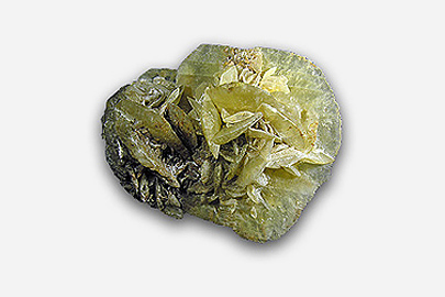
Pure gypsum is hydrous calcium sulphate (CaSO4.2H2O). It is a soft mineral, white when pure, but of varying shades of grey, yellow, red or brown if impure.
The main use for Victorian gypsum is for agricultural soil conditioning, although demand for this fluctuates in response to the rural economy and climatic conditions. There is, however, continuous demand for Victorian gypsum for use in cement manufacture.
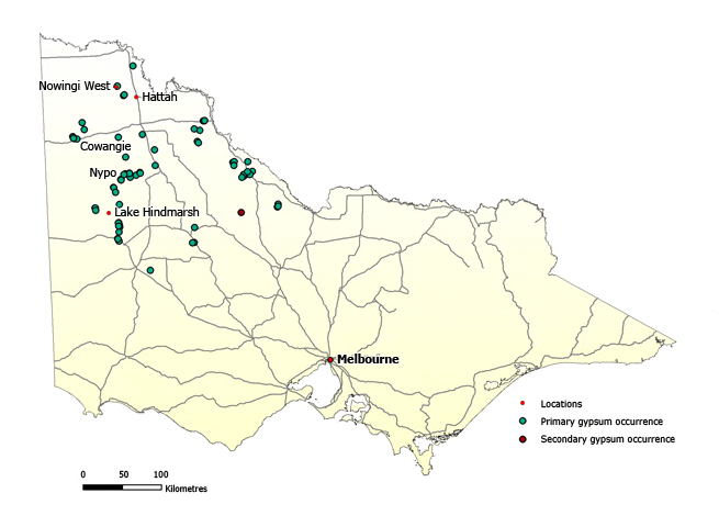
There are numerous gypsum deposits in the northwest of the state, in the Mallee and Wimmera districts. These deposits are in:
- dunes (copi deposits)
- crystalline gypsum accumulations buried at shallow depth in lake deposits in topographic basins
- crystalline deposits forming today in shallow lakes. These deposits form when saline groundwater is drawn to the surface by capillary action in hot weather, leading to fractional crystallisation of gypsum at or close to the surface.
There are five main production regions:
- the area between Kerang and Swan Hill
- a broad band between Dimboola and Lake Albacutya
- the area between Murrayville and Underbool
- Raak Plain and the area to the north and east of Lake Timboram
Geological data suggest there is potential for new, larger scale gypsum operations in northwestern Victoria.
Steady production of crystalline gypsum in Victoria is expected to continue to service cement manufacture and agriculture. There may also be market opportunities for gypsum to be used for water treatment (e.g. clay dispersion in dams), backfilling of mine stopes (a low-cost alternative to cement), and in the manufacture of lightweight building blocks.
View the full list of industrial minerals
Further information
Industrial minerals and rocks of Victoria – Geological Survey of Victoria Report 102
An accessible version of this document is currently not available. Work to create an accessible version may already be in progress or an accessible version can be provided on request. Please contact us if you need further information about this document.
Maps
To create your own maps online and in real time, plan exploration activities by viewing land status, or download GIS data to add to your own maps, visit GeoVic.

Page last updated: 01 Sep 2022