Linking from the Geophysical Survey Index to survey data on the GSV Online Catalogue
These instructions explain how to access survey reports and data directly from the GeoVic Airborne Geophysical Surveys Index.
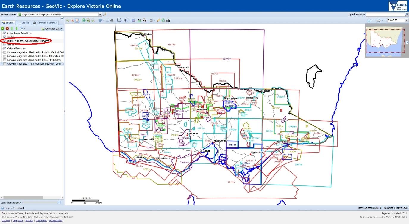
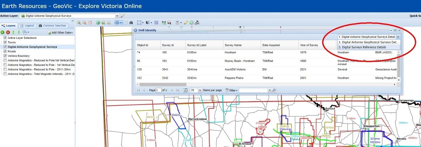
Turn on “Digital Airborne Geophysical Surveys” index layer.
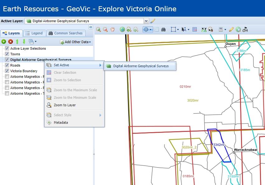
Set layer to active by right clicking on layer.
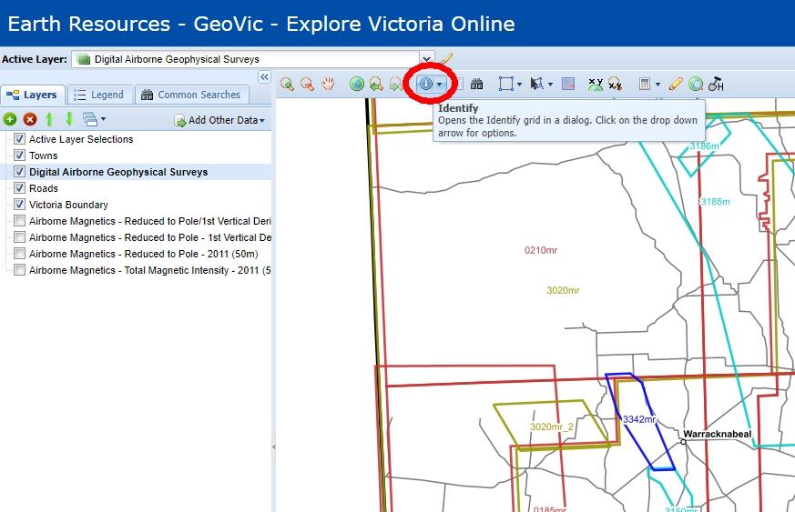
Click “Identify” button in top menu and click on survey of interest in map (or hold and drag to select area of interest).
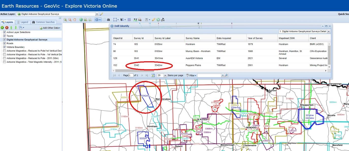
A list of intersected surveys is displayed in a pop-out dialogue showing survey metadata.
In the top right drop-down menu of the pop-out dialogue select “Digital Survey Reference Details”
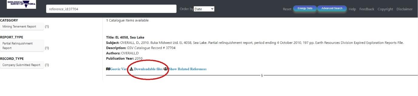
A list of available references and brief descriptions are displayed for each survey in the selected area. Scroll to find the survey of interest (note there may be multiple entries for a single survey) and click on the Search Assistant link.

A separate webpage will open showing the relevant Search Assistant catalogue item. Click on the “Downloadable files” link to display available files.
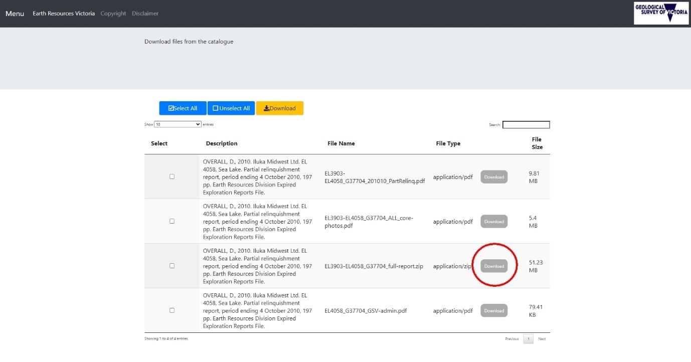
Select “Download” for the file(s) of interest. Note survey data is contained in zip file as in the example below.
Page last updated: 17 Aug 2023