Regional geophysical data
Regional pre-competitive geophysical data available in Victoria includes airborne and ground-based geophysical surveys.
Airborne geophysical survey data
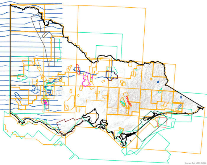
An airborne geophysical survey is a cost-effective way of covering a very large area in a short time. It enables consistent regional coverage over varied landscapes. An Airborne Geophysical Surveys Index is available and can be queried in GeoVic to assist in locating surveys over specific regions and obtaining survey acquisition information.
If available, survey reports and data can be downloaded by linking to the GSV Online Catalogue directly from the index.
Airborne Magnetics
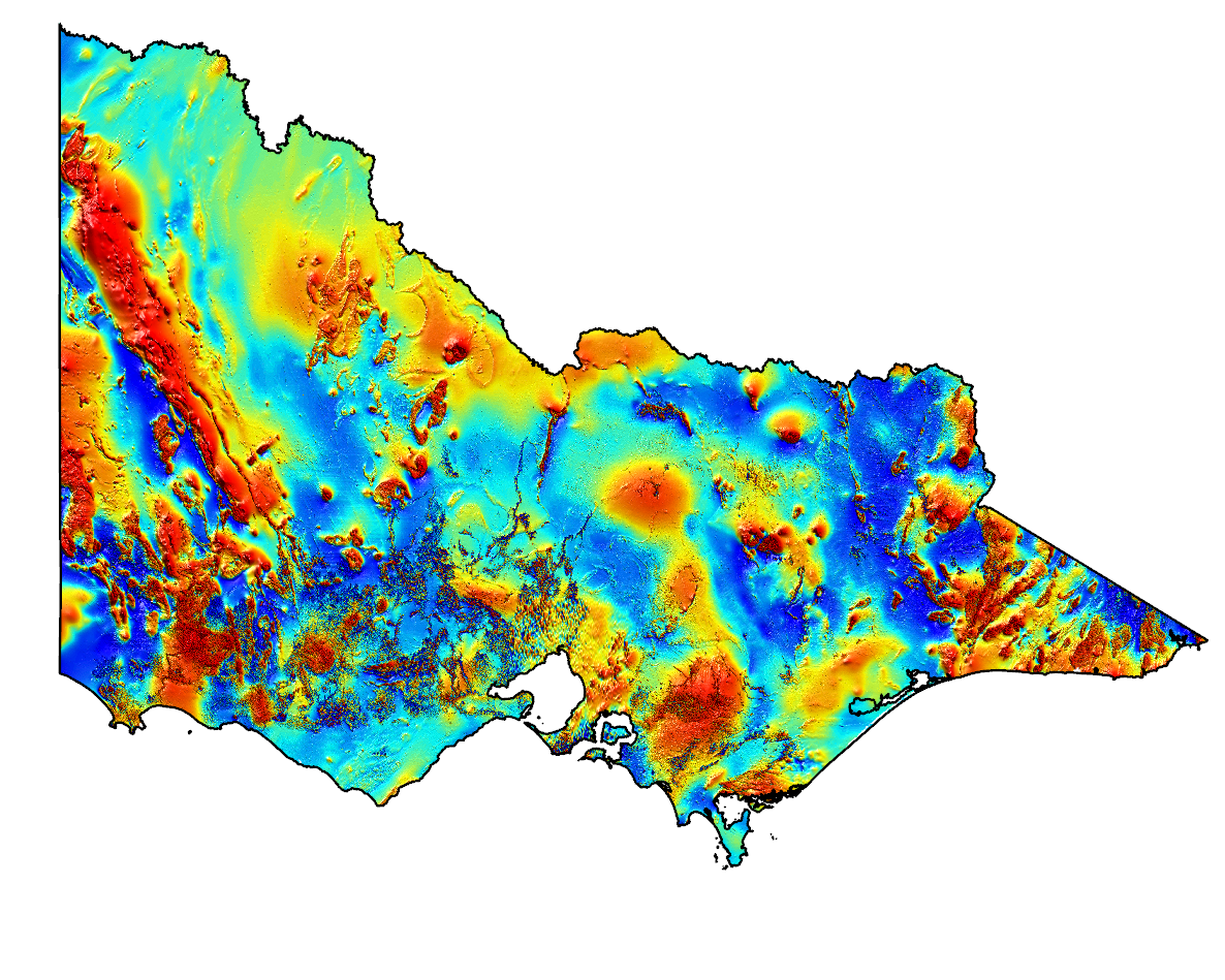
Magnetic surveys measure the earth's magnetic field. Local variations in the magnetic field are caused by near surface and/or deeper variations in the magnetic properties of the rocks. Interpretation of the data can provide information about the near surface and deeper geology and regional structural features. The data are used to assist with geological mapping, multi-disciplinary geological interpretations and in mineral and energy exploration programs. Coverage is state-wide at varying resolution, with nominal 200-400m spaced flight lines, and 50-100m flight height. Magnetic surveying is a passive technique.
Survey metadata and imagery can be found on GeoVic.
Search GADDS for Victoria's located and gridded airborne magnetic data.
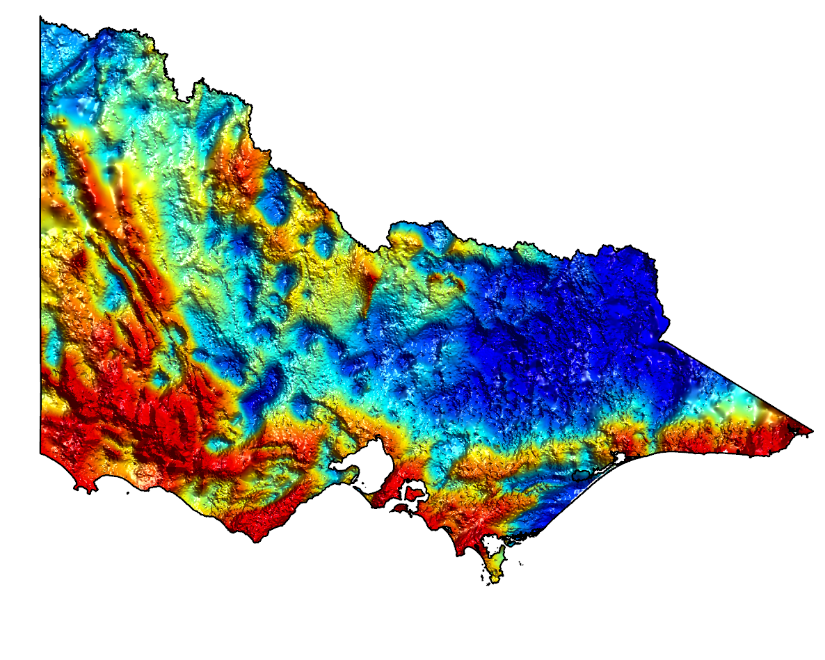
Airborne gravity and gravity gradiometry
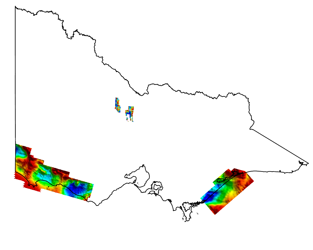 Airborne gravity and gravity gradiometry surveys are carried out by aircraft using state-of-the-art technology to detect extremely small variations in the Earth’s gravity field. These variations are related to differences in the density of rocks in the subsurface and can be interpreted to improve understanding about the location and shape of geological structures from the surface to a depth of more than 50kms. Airborne gravity surveying is a passive technique.
An Airborne Gravity Gradiometry Survey was flown as part of the Victorian Gas Program over approximately 16,000 km2 of the Otway Basin. A survey report and accompanying data package can be accessed here.
An Airborne Gravity Survey was also carried out for the Gippsland Nearshore (coastal) region as part of a feasibility study for the Carbon Capture and Storage initiative in the Gippsland Basin of Victoria.
Find available Victorian open-file airborne gravity and gravity gradiometry data via the GSV Online Catalogue.
Radiometrics
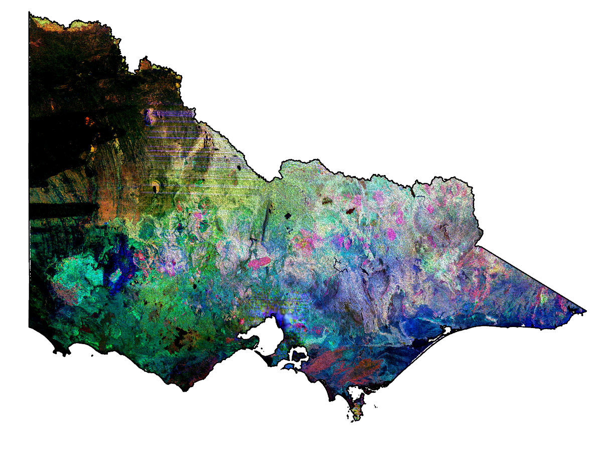
Radiometric surveys measure natural gamma radiation emanating from the earth's surface to a depth of about 30 cm. This gamma radiation is split into four channels - total radioelement count and three naturally occurring elements - potassium (K), thorium (Th) and uranium (U). The varying concentrations and distribution of radiometric potassium, thorium and uranium provide an indication of soil and rock characteristics. The data are used to assist with geological and soils mapping, mineral and energy exploration, and land management. Coverage is state-wide at varying resolution, with nominal 200-400m spaced flight lines, and 50-100m flight height. Radiometric surveying is a passive technique.
Survey metadata and imagery can be found on GeoVic.
Search GADDS for Victoria's located and gridded radiometric data.
Airborne Electromagnetics
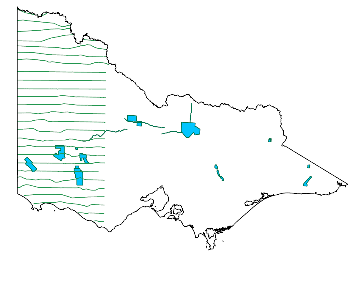
Electromagnetic surveys measure electrical conductivity variations in sediments and rocks from the surface down to several hundred meters. A variety of transmitter/receiver configurations and performances are available, resulting in different depth penetration. The latest systems enable the production of high-resolution 3D sub-surface conductivity information to assist with groundwater resource quality and salinity hazard assessment. The method is also used in mineral and energy exploration. Coverage is currently only over limited areas of the state.
Regional AEM data has recently been acquired by Geoscience Australia over western Victoria as part of the national AusAEM program, which is a component of the Exploring for the Future program. A data package is available from Geoscience Australia.
Victorian AEM survey metadata can be found on GeoVic.
Elevation models
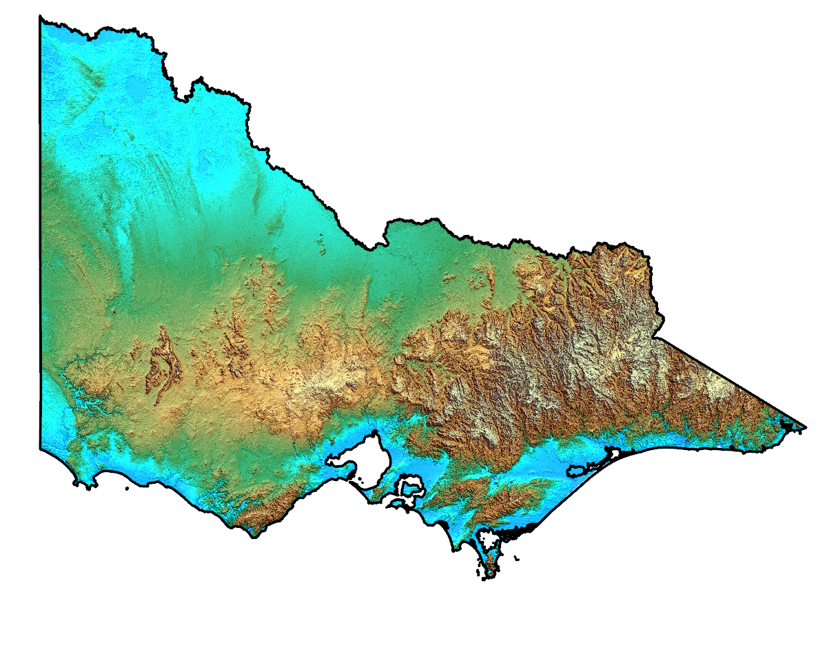
Digital elevation model data (DEM) are used to define landforms and in assessing land stability, it is the primary dataset in all forms of land and catchment management and is also important to the mineral and energy exploration industry.
Vicmap Elevation DEM 10m is available from DATA VIC.
Digital terrain model data (DTM) measures changes in elevation of the earth's surface as derived from the difference between aircraft height above sea level and ground clearance. These data are acquired concurrently as part of airborne geophysical surveys. State coverage of geophysical airborne survey derived DTM data is approximately 80%. This data is not as accurate as traditional surveying techniques.
Search GADDS for Victoria’s located and gridded elevation data.
The Airborne Geophysical Surveys Index is available to assist in locating these surveys and assessing the quality of the data.
Ground geophysical survey data
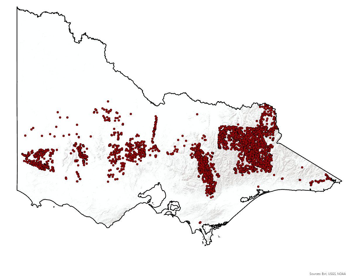
Ground gravity
Gravity data measures variations in the gravitational field of the earth. Local variations in the density of rocks in the Earth’s upper crust cause minute changes in the gravity field. Interpretation of this data can provide information about the geology and regional structural features from the surface to a depth of more than 50kms. The data are used to assist with geological mapping, multi-disciplinary geological interpretations and in mineral and energy exploration programs. Victoria’s ground gravity database currently comprises over 280,000 stations across the state at varying spatial resolution, with a nominal station spacing of 1.5 km. Ground gravity surveying is a passive technique.
Station locations and imagery can be found on GeoVic.
Search GADDS for Victoria's located and gridded ground gravity data.
Seismic surveys
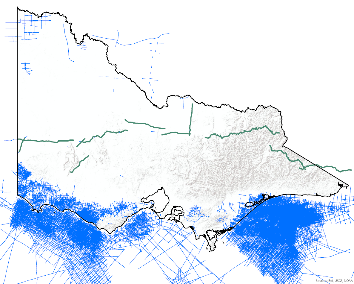
Seismic surveys image subsurface geological features by bouncing sound waves off different rock layers within the crust and recording the timing and strength of the returning sound waves. Seismic surveys are low impact and non-invasive and provide information utilised in geological mapping and 3D geological model development, geohazard analysis, mineral and energy exploration and carbon capture and storage analysis.
Victorian open file seismic survey line location information and associated metadata from can be accessed via GeoVic.
Access Victorian seismic data held by Geoscience Australia.
Information and data for the latest deep crustal 2D seismic transect can be accessed via the Southeast Lachlan Deep Crustal Seismic Reflection Survey page.
Magnetotellurics

Magnetotelluric (MT) data are collected by measuring variations in the Earth’s magnetic and electric fields to determine the electrical conductivity and resistivity structure of the Earth’s interior. The technique is a passive method utilising specialised equipment to record MT signals which provide information about the subsurface for depths ranging from kilometres to hundreds to kilometres. These data are used in multi-disciplinary geoscientific studies that incorporate a range of geological, geophysical and geochemical datasets.
More information about the MT method and data, including the AusLAMP project is available on the AusLAMP page of GeoScience Australia's website.
Petrophysical data
Petrophysical data represents the physical property measurements of rocks, and provides a crucial link between geology and its geophysical response. Knowledge of petrophysical properties in the context of lithological, stratigraphic and spatial relationships enables a more informed interrogation of associated geophysical datasets, and the interpretation of the corresponding geology. Regional pre-competitive petrophysical datasets provide a baseline that has the potential to highlight anomalous rock property values which, particularly in combination with other geoscientific datasets, can improve mineral and energy exploration targeting, and groundwater studies. The GSV petrophysical database comprises over 250,000 rock property measurements. Acquisition techniques include in situ (e.g., wireline, outcrop) and laboratory (e.g., drill core scanning) measurements for properties including magnetic susceptibility, density, electrical resistivity and conductivity, P-wave (sonic) velocity and porosity.
Selected petrophysical data are available for download as part of project data packages and compilations, and via request.
Search GADDS for Victoria’s petrophysical rock property data.
Page last updated: 17 Aug 2023